The heat came and pummeled us last week. We had thee straight days in the middle 90s with nasty levels of humidity. Thankfully, the refreshing air mass after the heat wave was stronger than expected, leading to a spectacular weekend finish
Don’t get used to the easy going weather, however — summer heat is still king. The 90s roar back during this forecast period along with more humidity. Like last week, we will cool down heading into the weekend and the start of next week.
We have a splattering of rain chances this week. First, thunderstorms and showers are likely west of the City on Wednesday. They could creep into Philadelphia proper too. The excessive heat and humidity could spark some storms on Thursday. Don’t change your Thursday plans, but be aware that they are possible. Sunday looks like the wettest day of the week as we could get a few hours of rain and thunderstorms. Tuesday throws us a shower chance as well.
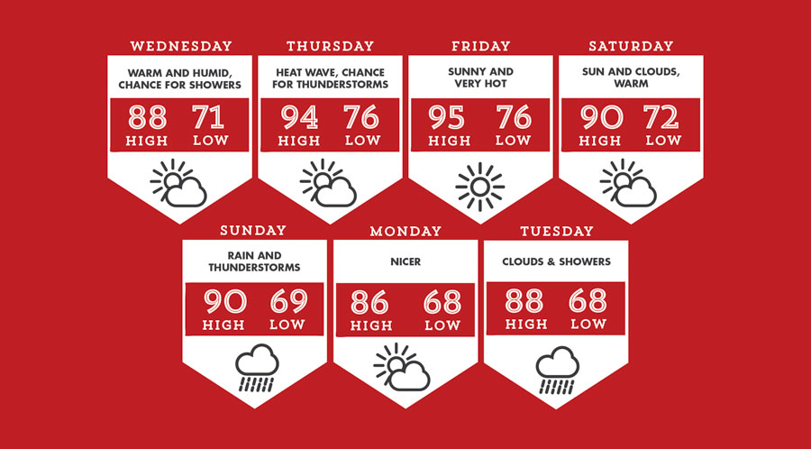
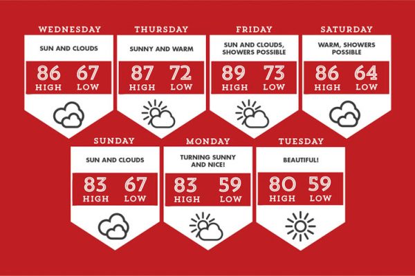
Wednesday kicks off the weather period warm and humid. It won’t be extreme heat so enjoy it!
Thursday and Friday are very hot and humid as another heat wave grips the region. Be careful doing activities outside.
Saturday looks like the better day of the weekend. It will be warm, but daytime temps will back off of extreme levels. It also should be dry for just about everyone.
Sunday will feature continued warmth, but also rain. A couple rounds of showers and thunderstorms should be expected, especially in the afternoon.
Temperatures will finally retreat into the 80s on Monday; sunshine will be plentiful as we go back to perfect summer weather. Rain chances come back for Tuesday but the extreme heat stays away.
The weather winner of the week is the Saturday; the weather loser is Thursday.